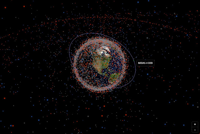
As reported by Gizmodo: Fellow space nerds, I come bringing sweet internet relief for the Monday doldrums. It’s stuffin.space, a real-time, 3D-visualized map of all objects looping around Earth, from satellites to orbital trash.
 |
| A view of the US GPS constellation satellite tracks. |
The site updates itself daily using the latest satellite data from Space Track, a US Department of Defense website, which monitors satellites and space junk that are at least the size of a standard softball. (This excludes top-secret military satellites, of course.) In total, stuffin.space tracks 150,000 objects. Type in a satellite name to scope out its altitude, figure out its age, group satellites by type, and so on.
It started as a passion project in April for 18-year-old James Yoder, an alum of FIRST Robotics, the high school robotics competition. He wanted to learn more about 3D graphics programming and WebGL, a JavaScript API.
“Using those orbital parameters, stuffin.space uses a propagation model to predict the location of every satellite in real time, with an accuracy of within a few kilometers, and displays the data using a WebGL visualization with an accurate view of the Earth’s rotation and sunlight angle,” Yoder told Gizmodo in an email.
Yoder heads to college this fall to study electrical engineering at the University of Texas, Austin. A homemade site mapping Earth’s orbital bric-a-brac in real-time? Not a bad project for an incoming freshman to have under his belt.


No comments:
Post a Comment