Search This Blog

Wednesday, July 23, 2014

Video: SpaceX's Falcon 9 Rocket Landing in the Atlantic Ocean

As reported by GigaOm: SpaceX’s Falcon 9 rocket is now equipped with landing legs, which could eventually allow it to be reusable–a crucial step toward lowering the cost of carrying cargo to space. The space startup released a video today taken from the surface of the rocket as it passed through the planet’s atmosphere and crashed into the Atlantic Ocean. 

“The water impact caused loss of hull integrity, but we received all the necessary data to achieve a successful landing on a future flight,” a blog post states. “At this point, we are highly confident of being able to land successfully on a floating launch pad or back at the launch site and refly the rocket with no required refurbishment.”


Monday, July 21, 2014

Search-and-Rescue Drone Mission Readies for Takeoff After Defeating FAA

As reported by ArsTechnia: A Texas volunteer search-and-rescue outfit that uses five-pound drones to find missing persons is resuming operations following its Friday courthouse victory against US flight regulators.

Federal Aviation Administration officials in February grounded Texas EquuSearch Mounted Search and Recovery Team, which deployed the unmanned aircraft to search for the missing for free.

EquuSearch, which does not charge for its services, says it has found more than 300 persons alive in some 42 states and eight countries. It challenged the FAA's order and, indirectly, prevailed. The US Court of Appeals for the District of Columbia Circuit found [PDF] that the e-mail from the FAA to EquuSearch was not the official method for a cease-and-desist order.

"The court's decision explains that Texas EquuSearch is not under any FAA mandate to stop using civilian drones to help families find their missing loved ones. Therefore, the organization and its volunteers plan to resume their use of this life-saving technology immediately," Brendan Schulman, the group's attorney, said in an e-mail.

In response, the FAA said the decision, however, "has no bearing on the FAA's authority to regulate" the commercial use of drones. The agency did not say whether it would commence official proceedings against EquuSearch to enforce its 2007 ban on the commercial use of drones in the US.

Schulman maintains that the agency's 2007 edict cannot be enforced at all because of a different court ruling.

In March, a federal judge ruled that the FAA's ban on the commercial use of drones was not binding because flight officials did not give the public a chance to comment on the agency's rules. Congress has delegated rule making powers to its agencies, but the Administrative Procedures Act requires the agencies to provide a public notice and comment period first.

The agency has promised that it would revisit the commercial application of small drones later this year, with potential new rules in place perhaps by the end of 2015. But for now, the agency is taking a hard-line against the commercial use of drones, and it's unclear whether that policy would change.

The National Park Service banned drones from being flown throughout the park system last month.

The FAA also reiterated its rules last month to make clear that proposed drone-delivery services like the one Amazon.com has proposed won't be coming to consumers' front doors anytime soon. The FAA also said the small drones were barred from a number of uses, including:
  • Determining whether crops need to be watered that are grown as part of a commercial farming operation.
  • A person photographing a property or event and selling the photos to someone else.
  • A Realtor using a model aircraft to photograph a property that he is trying to sell and using the photos in the property's real estate listing.
  • Receiving money for demonstrating aerobatics with a model aircraft.

Friday, July 18, 2014

GPS Location Big-Data Reveals City's Most Important Crossroads

As reported by MIT Technology Review: Here’s an interesting question: how do you identify the most important junctions in a city? One way it is to measure the origin, route, and destination of each road trip through a city and then work out where they cross.

That’s never been possible in the past because this kind of data has always been hard to collect. But in recent years, the growing use of GPS navigating devices has changed all that.

Today, Ming Xu at Tsinghau University in Beijing and a few pals have collected the GPS data from hundreds of thousands of taxi journeys in Beijing and use it to do exactly this calculation. The result is a comprehensive map of the most important crossroads in Beijing, information that traffic planners could make good use of to keep the traffic flowing during roadworks, building projects, and so on.

Beijing has a population of more than 21 million people and its road traffic network is correspondingly huge. It contains 13,722 crossroads connected by over 25,000 roads. The network of roads in Beijing is dominated by four more or less concentric ring roads along with a number of arterial routes that head into the city center. To discover the most important of these crossroads, Ming and co used the routes taken by 10,000 taxicabs in Beijing during the month of October 2012.

This dataset consisted of each taxi’s GPS location sampled around once a minute. The team was particularly interested in the peak traffic conditions and so used only the data taken between 7:30 a.m. and 10 a.m. and between 5 p.m. and 7:30 p.m. This consisted of more than 500,000 fare-paying taxi trips between one location and another.

First, they mapped each of these trips onto a map of Beijing to determine the origin, route and destination of each. They also counted the number of crossroads traversed on each trip, a number that varied mainly between 7 and 18. That allowed the team to calculate things like the amount of traffic that passes through any given crossroads during the peak commuter period.

But then notion of an “important crossroad” is more subtle in Ming and co’s model of a city and they use a Pagerank-style algorithm to calculate this.

The Pagerank algorithm is Google’s famous method for ranking important webpages. It judges a webpage to be important if it is linked to by other important webpages. It works by a process of iteration, in which the importance of each webpage is calculated at every step and this is then used to update the calculation in the next step.

Ming and co use the same approach to rank the importance of crossroads. In their algorithm, called CRRANK, a crossroad is important if it is linked to by important roads. And roads are important if they link important crossroads. By iterating this algorithm, a ranking of important crossroads emerges.

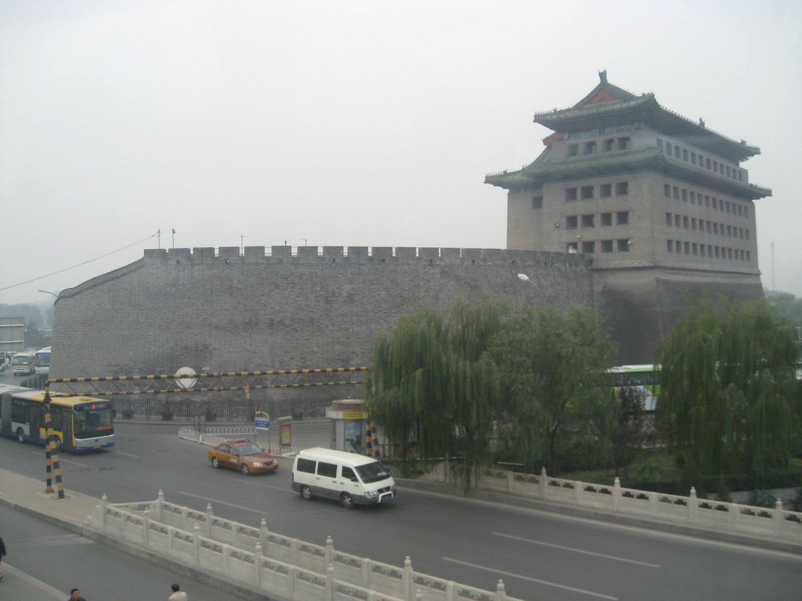
Deshengmen City Gate Tower
The results clearly show which crossroads in Beijing are the most significant. The most important is called Deshengmen Bridge. It is the junction of the second ring road with the Badaling Expressway, near the Deshengmen city gate in the northern part of the city wall. It is well known as a major transportation mode.

The second is Xuanwumen Bridge in the southern part of the city and the former location of another gate in the city wall. It is also known as a major transportation hub.

The ranking lists over 100 important, with the most important being on the second ring road. It picks out important junctions on the third and fourth ring roads as well, which are further out. But the trend is that more important junctions tend to be nearer the center. “This is consistent with our daily experience,” say Ming and co.

Incidentally, the most important route is between Jinrong Street in the center of town and Beijing airport.

That’s an interesting way of ranking the importance of crossroads. Other groups have studied the network of roads within cities by creating a model of road traffic, and then removing nodes to see how the network performs without them. This simulates the crossroads becoming blocked by an accident, for example. That also reveals crucial junctions, some of which are so important that entire cities can come to a standstill when they become blocked.

The trouble with these earlier studies is that they have to be done with traffic flow simulations. But the availability of large amounts of high quality traffic data from real vehicles makes this kind of work much more valuable. There’s no reason now why these different approaches can’t be combined in future.

That should help when planning traffic flow during building works.

Nevertheless, the traffic in big cities has always been bad. Victorian commentators describe people running over the roofs of horse-drawn cabs in the traffic-jammed streets of 19th-century London. Any Londoners reading this will know that things haven’t improved much since then.
But with data like this and the ability to number crunch it effectively, perhaps it is reasonable hold out a small candle of hope that traffic jams will become a thing of the past. Then again, possibly not.

Ref: arxiv.org/abs/1407.2506 : Discovery of Important Crossroads in Road Network using Massive Taxi Trajectories

Wednesday, July 16, 2014

New Driver's Seat Monitors Your Heart, Knows When You're Falling Asleep

As reported by MotorAuthority: Soon, your car may know your heart rate—and may take control from you if it doesn't like what it sees.

A new project from Nottingham Trent University in the UK is working on an electrocardiogram (ECG) built into the driver’s seat to detect heart rate and determine when the driver is too fatigued—or worse, falling asleep—in order to improve road safety.

The technology uses circuits integrated into the seats, called Electric Potential Integrated Circuits, or EPIC. Developed by Plessey Semiconductors, the EPIC circuit can measure heart rate, respiration, and more to monitor alertness and health.

Plessey business development director Steve Cliffe told industry trade publication Innovation in Textiles, "We are extremely excited to be working with Nottingham Trent University on this TSB funded program. For the first time it will be possible to reliably and robustly extract electrophysiology signals using Plessey EPIC sensors in an automotive environment without direct contact with the body."

Ideally, the system could be integrated with active cruise control, lane-keeping functions, and more, to take over if a driver ignores or fails to respond to the car’s warnings about alertness.


EPIC automotive sensors could monitor driver alertness for safety. Image via Plessey Semiconductors.

The result? Accident mitigation or avoidance in cases of driver fatigue, and potentially other situations, such as heart attack, as well. There's a certain element of discomfort for some when thinking about their car knowing so many intimate details of their biology, especially if it has the ability to take control from the driver, but at the same time, the EPIC sensors, applied in this fashion, could save lives.

The technology is still in a nascent phase, with materials challenges like conductive textile technology required for the ECG electrodes woven into the seat backs. This is the area of research being investigated by researches at NTU.

Due to complexity and cost, the initial applications are expected to come in the commercial driving arena, helping to ensure truck drivers stay safe behind the wheel.

Eventually, it could expand into the private automobile market, likely starting at the high-end luxury realm as so many other new technologies do.

New Miniaturized GPS/Galileo Anti-Jamming Technology

As reported by GPS WorldChemring Technology Solutions has developed miniaturized GPS anti-jamming technology it has dubbed GINCANGINCAN is designed to combat illegal GPS jammers and is based on the adaptive antenna concept used by military systems. GINCAN has a chip footprint of six millimeters squared.

GINCAN’s reduced size and weight will significantly cut power usage and cost, the company said, making it ideal for combating the widespread problem of low-powered GPS jamming. GINCAN can be integrated into a range of applications, including in-vehicle satellite navigation systems and cellular technology, and can be used for the protection of the critical infrastructures which rely on GPS to provide positioning and timing.

GPS jammers have already been developed to interfere with the European Union’s Galileo system, which will provide European satellite navigation independently from the Russian, USA and Chinese systems by 2019. Chemring Technology Solutions, based in Romsey, England, has anticipated this problem and its GPS anti-jamming technology will also support systems using Galileo.

Once the preserve of the military, there is now an increasing demand for GPS protection in the civilian market as illegal GPS jamming equipment becomes widely available on the Internet. The £1.5 million government-funded Sentinel project, designed to measure GPS jamming on UK roads, recorded more than 60 individual jamming incidents across six months at a single location. Such attacks could seriously impact industries, including maritime, aerospace, the emergency services and even stock market trading.

“Many years of developing GPS protection technology for the military has enabled our research and development team to miniaturize anti-jamming technology,” said Martin Ward, product manager, Chemring Technology Solutions. “GINCAN can now be easily integrated in to a range of applications to provide effective protection against jamming devices.

“As we become increasingly reliant on GPS technology, and low-cost jammers are proliferating, so a potential time bomb is being created. Chemring Technology Solutions is now able to offer the answer to this problem with jammer protection at a reduced size, weight, power and cost footprint.”

GINCAN is an export controlled product and subject to UK export restrictions.

SpaceX Rocket Launches Six Satellites, and Completes Reusibility Test

As reported by the Christian Science Monitor: The private spaceflight company SpaceX launched six commercial satellites into low-Earth orbit on July 14th in a mission that was expected to include a key rocket-reusability test.

The company's Falcon 9 rocket streaked into space from the pad at Florida's Cape Canaveral Air Force Station at 11:15 a.m. EDT (1515 GMT) Monday, carrying six spacecraft for the satellite-communications firm ORBCOMM.

The satellites are the first members of the OG2 (short for "ORBCOMM Generation 2") constellation, which should provide a big upgrade over the current OG1 network, company officials said. SpaceX is expected to launch a total of 17 OG2 craft using the Falcon 9. [See photos of the SpaceX launch]

The OG2 satellites, which weigh about 375 lbs. (170 kilograms) each, were built by Sierra Nevada Corp. They're destined for an elliptical orbit that will take them between 382 and 466 miles (615 to 750 kilometers) above Earth's surface.

A successful delivery of the OG2 satellites may have been the main objective of Monday's launch, but it wasn't the only one. SpaceX also aimed to bring the Falcon 9's first stage back to Earth in a soft ocean-splashdown, to test out and advance reusable-rocket technology. It was not clear immediately after liftoff how well this test went.

Developing fully and rapidly reusable launch vehicles is a key priority of SpaceX's billionaire founder Elon Musk, who has said that this breakthrough could slash the cost of spaceflight by a factor of 100. In doing so, reusable rockets could help open the solar system for manned exploration, perhaps even making a Mars colony economically feasible.

SpaceX attempted a similar first-stage return during the last Falcon 9 liftoff in April, which blasted the robotic Dragon capsule toward the International Space Station on a cargo mission for NASA. That test went well; data showed that the rocket stage did indeed make a controlled landing in the Atlantic Ocean, though rough seas destroyed it before recovery boats could reach the splashdown scene.

Monday's launch was originally planned for May 10, but the cancellation of a pre-launch Falcon 9 static-fire test and scheduling constraints pushed the liftoff back by about two months. The launch also comes on the heels of SpaceX receiving certification from the U.S. Air Force of its Falcon 9 rocket after three successful flights, a major step in the company's plan to compete for U.S. military satellite launch contracts. 

Thursday, July 10, 2014

How Google Map Hackers Can Destroy Small Business

As reported by Wired: Washington DC-area residents with a hankering for lion meat lost a valuable source of the (yes, legal) delicacy last year when a restaurant called the Serbian Crown closed its doors after nearly 40 years in the same location. The northern Virginia eatery served French and Russian cuisine in a richly appointed dining room thick with old world charm. It was best known for its selection of exotic meats—one of the few places in the U.S. where an adventurous diner could order up a plate of horse or kangaroo. “We used to have bear, but bear meat was abolished,” says proprietor Rene Bertagna. “You cannot import any more bear.”

But these days, Bertagna isn't serving so much as a whisker. It began in early 2012, when he experienced a sudden 75 percent drop off in customers on the weekend, the time he normally did most of his business. The slump continued for months, for no apparent reason. Bertagna’s profits plummeted, he was forced to lay off some of his staff, and he struggled to understand what was happening. Only later did Bertagna come to suspect that he was the victim of a gaping vulnerability that made his Google listings open to manipulation.

He was alerted to that possibility when one of his regulars phoned the restaurant. “A customer called me and said, ‘Why are you closed on Saturday, Sunday and Monday? What’s going on?’” Bertagna says.

It turned out that Google Places, the search giant’s vast business directory, was misreporting the Serbian Crown’s hours. Anyone Googling Serbian Crown, or plugging it into Google Maps, was told incorrectly that the restaurant was closed on the weekends, Bertagna says. For a destination restaurant with no walk-in traffic, that was a fatal problem.

“This area where the restaurant is located is kind of off the beaten path,” says Bertagna’s lawyer, Christopher Rau. “It’s in a wealthy subdivision of northern Virginia where a lot of government employees live on these estates and houses with two- or three-acre lots … It’s not really on the way to anything. If you’re going there, it’s because you've planned to go there. And unless you know that the place is going to be open, you’re probably not going to drag yourself out.”

Bertagna immigrated to the U.S. from northern Italy when he was young. He’s 74 now, and, he says, doesn't own a computer—he’d heard of the Internet and Google but used neither.

Suddenly, a technological revolution of which he was only dimly aware was killing his business. His accountant phoned Google and in an attempt to change the listing, but got nowhere.


Bertagna eventually hired an Internet consultant who took control of the Google Places listing and fixed the bad information—a relatively simple process.

But by then, Bertagna says, his business was in a nose dive from which he couldn't recover—service suffered after the layoffs, and customers stopped coming back. He shuttered the Serbian Crown in April 2013.

Bertagna puts the blame for his restaurant’s collapse on Google, and he’s suing the company in federal court in Virginia. His lawyer’s theory is that a competing restaurant sabotaged the Google Places listing to drive away the Serbian Crown’s customers, and he argues that Google turns a blind eye to such shenanigans. Google’s lawyers scoff at the lawsuit. “The Serbian Crown should not be permitted to vex Google or this Court with such merit-less claims,” they wrote in a filing last month. (Google didn't respond to repeated inquiries for this story)

For a number of reasons, the claim is probably doomed in court. But the premise of the lawsuit—that the Serbian Crown was sabotaged online—isn't as far fetched as it might seem.

Beneath its slick interface and crystal clear GPS-enabled vision of the world, Google Maps roils with local rivalries, score-settling, and deception. Maps are dotted with thousands of spam business listings for nonexistent locksmiths and plumbers. Legitimate businesses sometimes see their listings hijacked by competitors or cloned into a duplicate with a different phone number or website. In January, someone bulk-modified the Google Maps presence of thousands of hotels around the country, changing the website URLs to a commercial third-party booking site (which siphons off the commissions).

Small businesses are the usual targets. In a typical case in 2010, Buffalo-based Barbara Oliver & Co Jewelry saw its Google Maps listing changed to “permanently closed” at the exact same time that it was flooded with fake and highly unfavorable customer reviews.

We narrowed it down as to who it was. It was another jeweler who had tampered with it,” says Barbara Oliver, the owner. “The bottom line was the jeweler put five-star reviews on his Google reviews, and he slammed me and three other local jewelers, all within a couple of days.”

Oliver’s Google Maps listing was repaired, because she had something Bertagna didn't have: a web consultant on retainer feeding and caring for her Internet presence. That consultant, Mike Blumenthal, says he’s countered a lot of similar tampering over the years.

“I had a client whose phone number was modified through a community edit,” says Blumenthal, who closely tracks Google Maps’ foibles in his blog. “It was a small retail shop—interior design. I traced it back to a competitor who left a footprint.”

These attacks happen because Google Maps is, at its heart, a massive crowd-sourcing project, a shared conception of the world that skilled practitioners can bend and reshape in small ways using tools like Google’s Mapmaker or Google Places for Business.

Google seeds its business listings from generally reliable commercial mailing list databases, including infoUSA and Axciom. Once it’s in Google’s index, a business owner can claim a listing through Google and begin curating it for free, adding photos, hours of operation, a website address. Once your have that relationship with Google, the company will up-sell you on paid advertising, which, after all, is Google’s financial lifeblood.  

But if you ignore your Google Maps listing, you’re inviting trouble. Ordinary users can submit community edits to your listing with details like operating hours—as Barbara Oliver discovered.

A screenshot of a spam locksmith positioned in the ocean three miles off the San Francisco coast.

Blumenthal says Google has gotten much better at policing malicious edits, to the point where they’re rare today. “Most of these problems of community edit abuses were in the 2010 and 2011 range,” he says. Fake map listings are a less tractable problem. Google allows anyone to enter a new business into Maps, and to place it wherever they like. The company keeps the listing invisible until it’s been verified through old fashioned snail-mail. Google sends out a postcard with a PIN code, and the business owner activates the listing by typing in the PIN.

The system has loopholes though, and troves of money-hungry spammers looking for weaknesses. In February, an SEO consultant-turned-whistle-blower named Bryan Seely demonstrated the risk dramatically when he set up doppelganger Google Maps listings for the offices of the FBI and Secret Service. Seely channeled the incoming phone calls through to the real agencies while recording them.

The stunt got a lot of attention. The Secret Service told Seely he was “a hero” for showing them the vulnerability. But despite the coverage Seely says some of his methods remain operable today. He proved it to me by creating a cheeky Google Maps listing in my name at 1600 Pennsylvania Avenue. “The heat died down and almost all of the holes are still open,” Seely says.

Seely’s guess is that Serbian Crown was indeed a victim of Google Maps sabotage. “People do it all the time—people have even offered me money to get listing spammed or banned,” he says. “There are legitimate businesses being put of out business.”

Demonstrating causation between a bad Google Maps listing and Serbian Crown’s decline is going to be hard, though. For one thing, the restaurant’s Yelp listing—also a big factor in choosing a dinner reservation—is packed with abysmal, almost frightening, reviews. And there are any number of reasons a restaurant—even an old, established one—can fail, as Google’s lawyers pointed out an angry June 17 motion to dismiss the lawsuit.

“As the complaint tells it, The Serbian Crown restaurant was forced to close its doors not because of rising rents, difficulty sourcing ingredients, declining quality, poor service, changing tastes, poor business decisions, increased competition, or any of the other myriad reasons that can cause an established restaurant to struggle,” wrote attorney Creighton Macy, of the law firm Wilson Sonsini Goodrich & Rosati.

“Rather than accept that restaurants, even longstanding ones, sometimes fail, the owner of this particular restaurant looked around for someone to blame,” the lawyer wrote. “Who did he settle on? Google.”

Even if Bertagna can prove the facts, as a legal matter Google is probably untouchable because of Google Maps crowdsourced nature. A federal law called CDA 230 gives Internet services broad immunity from claims stemming from user-contributed content.

For his part, Bertangna says he hopes to reopen his restaurant some day and begin serving lion again. “It’s like a veal. We served it with a white mushroom, sauce and vegetables.”  Google Maps is not optimistic about his chances. Today Serbian Crown’s listing reads simply, “Permanently closed.”